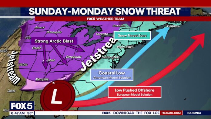
New Jersey residents heading into the Martin Luther King Jr. holiday weekend are being advised to prepare for a complicated stretch of winter weather, as multiple rounds of precipitation are expected to move through the region over the next several days. Forecasts indicate a shifting mix of snow, rain, and potentially slick conditions that could impact travel plans and outdoor events statewide.
The first phase of the system is projected to arrive late tonight, with snow developing overnight and continuing into Saturday morning. Accumulations during this initial round are expected to vary by location, with colder inland areas more likely to see steadier snowfall, while coastal and southern sections may experience a quicker transition to mixed precipitation. As temperatures rise later Saturday, snow is expected to taper off and change to rain in many areas.
Conditions are forecast to remain unsettled through Sunday, when a second weather disturbance is expected to cross the state. This system could bring another round of snow during the afternoon and evening hours, particularly as colder air moves back into the region. Forecasters caution that the timing of this second wave could coincide with increased holiday travel, raising the risk of slippery roadways and reduced visibility.
State and local officials are urging drivers to monitor conditions closely and allow extra time when traveling, especially during periods of changing precipitation. Residents are also encouraged to stay informed through updated weather reports as forecasts continue to evolve.
With fluctuating temperatures and multiple rounds of precipitation expected, the MLK holiday weekend is shaping up to be a reminder that winter conditions can change quickly across New Jersey. Preparedness and caution will be key as the state navigates another active winter weather pattern.


