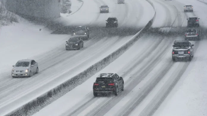
New Jersey officials are preparing for a severe winter storm expected to bring widespread snow, sleet, and freezing rain across the state, prompting Acting Governor Tahesha Way to declare a State of Emergency effective 1:00 p.m. on Friday, December 26, 2025. The executive order, covering all 21 counties, aims to safeguard residents, protect critical infrastructure, and allow emergency services and road crews to respond effectively as hazardous conditions develop.
Meteorologists are highlighting the complexity of this system, which will impact the state differently depending on location. Northern New Jersey is forecast to see predominantly snow, with accumulations expected to reach 5 to 8 inches in areas such as Sussex, Passaic, Bergen, and northern Morris and Essex counties. Central New Jersey faces a mixed scenario of snow transitioning to sleet, particularly across Hunterdon, Mercer, and parts of Monmouth counties, while southern portions of the state, including Cape May and southern Cumberland counties, could see sleet shifting to rain by the end of the storm. The variability of precipitation—ranging from heavy snow to ice pellets—presents challenges for forecasting and travel safety, particularly along the densely populated corridor between Northern and Southern New Jersey.
“This storm will bring dangerous outdoor conditions and significantly impact holiday travel,” Governor Way said. “We are urging all residents to avoid non-essential travel, allow crews to maintain road safety, and follow all safety protocols to minimize risk.”
The New Jersey Department of Transportation has preemptively deployed crews and contractors across major highways and critical routes to ensure roads remain as safe as possible during peak storm activity. In addition, a commercial vehicle restriction has been issued for tractor-trailers, empty CDL trucks, RVs, motorcycles, and passenger vehicles towing trailers along I-78, I-80, I-280, I-287, and Route 440 beginning at 3:00 p.m. today.
Meteorologists caution that the heaviest precipitation rates are expected between 7:00 p.m. and 3:00 a.m., with the storm lasting through the overnight hours into early Saturday morning. Residents are advised to remain indoors by mid-afternoon to ensure personal safety and to prevent becoming stranded in hazardous conditions. The cold air throughout the region will support wintry precipitation, meaning that even areas transitioning to sleet may still experience slick roads and accumulation capable of affecting travel.
Northern New Jersey will experience classic snowstorm conditions, while central New Jersey will see mixed snow and sleet, and southern New Jersey will face primarily ice, though sleet is expected to dominate most of the storm. The presence of sleet, which forms when snow melts in a warm layer aloft before refreezing into ice pellets at lower elevations, is less likely to cause tree and power line damage compared to freezing rain, but it still poses significant travel hazards.
Residents are encouraged to monitor conditions closely through official sources, including local forecasts and updates from the U.S. National Weather Service. Those in Northern New Jersey and the New York Metro area can track developments through the NWS New York office, while Central and Southern New Jersey residents should consult NWS Philadelphia/Mount Holly. Additional resources and emergency guidance are available through New Jersey’s weather updates, which provides continuous coverage and safety information throughout the storm.
With winter conditions expected to persist over the weekend, officials are emphasizing preparedness. Residents are urged to stock emergency supplies, avoid unnecessary travel, and allow state and local crews to manage snow and ice removal. The storm represents a statewide challenge, and authorities stress that careful planning and adherence to safety advisories are essential to minimizing risks during this powerful winter system.


