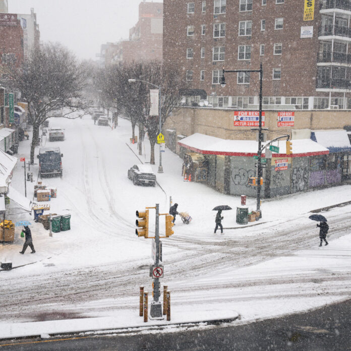
State of Emergency Declared as Powerful Snowstorm Slams Region, Paralyzing Roads, Airports, and Daily Life
New Jersey is bracing for one of the most consequential winter weather events of the season as a powerful Arctic storm system advances across the state, prompting sweeping travel restrictions, government closures, and emergency declarations. Governor Mikie Sherrill issued a statewide state of emergency on Sunday, January 25, 2026, as heavy snow, ice, and extreme cold combined to create hazardous conditions from South Jersey to the northern highlands.
All state and interstate highways have seen speed limits reduced to 35 miles per hour as road crews struggle to keep pace with rapidly deteriorating conditions. At Newark Liberty International Airport, more than 500 flights have already been canceled, with additional delays expected as snowfall intensifies and ice accretion becomes a growing concern. Travelers are strongly urged to monitor evolving transportation conditions and avoid unnecessary movement, particularly during peak snowfall periods. Ongoing updates related to regional transportation impacts can be found within Sunset Daily News’ comprehensive New Jersey transportation coverage.
Snowfall totals are expected to reach 8 to 12 inches across much of the state, with the most elevated northwest locations potentially exceeding 18 inches. State offices will remain closed Monday, January 26, and school districts statewide have already announced closures or delayed openings due to treacherous roadways and dangerously cold temperatures.
This storm represents the final warning as New Jersey heads into what meteorologists are describing as a long-duration, high-impact Arctic pattern. Sunday is expected to be an all-day weather emergency, with conditions worsening rapidly overnight and persisting into Monday morning. Forecast confidence has increased in recent hours, with two late-developing trends sharpening the threat: the inland reach of mixed precipitation has held steady or edged slightly farther northwest, while snowfall rates on the storm’s front end have intensified across South Jersey and parts of Central Jersey.
The storm will unfold in three distinct phases, each bringing its own hazards.
The first phase begins late Saturday night and extends through midday Sunday. Light snow is expected to reach southwestern and southern portions of the state between approximately 10 p.m. and 1 a.m., spreading into Central Jersey by around 5 a.m. and North Jersey by about 7 a.m. As colder Arctic air dominates the region, snow will quickly intensify, transitioning from light accumulations to periods of moderate and then heavy snowfall. Temperatures ranging from 10 to 18 degrees will support exceptionally high snow-to-liquid ratios, allowing snow to pile up rapidly.
Between roughly 5 a.m. and noon Sunday, snowfall rates of one to two inches per hour are possible across South and Central Jersey, marking the most intense portion of the storm for those regions. This window will account for the bulk of snow accumulation south of Interstate 78. While forecast models suggest a conservative range, forecasters are not ruling out localized overperformance, including the possibility of brief but extreme snowfall bursts that could push totals higher than currently projected.
Around midday Sunday, the storm will enter its second phase as sleet begins to intrude into South Jersey. The transition zone will push northward over the course of one to two hours, reaching the Interstate 95 and New Jersey Turnpike corridor by early afternoon. Central Jersey may continue accumulating snow for a short period during this transition, potentially adding several additional inches if heavy rates persist before sleet takes over.
From noon through mid-afternoon, much of South and Central Jersey will experience a punishing combination of sleet and snow, with sleet accumulations possibly exceeding an inch in some areas. North Jersey, however, is expected to remain predominantly snow during this phase, allowing totals there to continue climbing. As the afternoon progresses, sleet is forecast to change to freezing rain as far north as the I-95 corridor, with extreme southeastern areas briefly seeing plain rain. Ice accumulation during this period raises concerns for downed tree limbs and sporadic power outages, even in the absence of strong winds.
The final phase begins late Sunday night and continues through Monday morning. By approximately 11 p.m., precipitation should taper off across South and Central Jersey. North Jersey, particularly areas north of Interstate 78, may continue to see lighter snow showers overnight into mid-morning Monday. While additional accumulations are expected to be modest, they will add to already significant totals and further complicate cleanup efforts.
Overall, North Jersey is expected to remain largely snow-dominant throughout the entire storm, prompting the issuance of a high-impact snowfall warning for areas north of I-78. Elsewhere in the state, officials continue to monitor the potential for sudden shifts in precipitation type that could elevate impacts beyond current projections.
In plain terms, this is a prolonged Arctic winter storm that will disrupt nearly every aspect of daily life across New Jersey. Sunday will be the most dangerous period, with heavy snow, sleet, and ice combining to make travel nearly impossible at times. While damaging winds are not expected, the presence of freezing rain introduces the risk of power disruptions caused by ice-laden branches and infrastructure stress.
Residents are urged to complete preparations immediately, remain off the roads whenever possible, and be ready for extended cold that may persist for weeks beyond the storm’s conclusion. Emergency management officials emphasize that even as snowfall ends, lingering ice, frigid temperatures, and cleanup challenges will keep conditions hazardous well into the start of the workweek.


